All posts by admin

Lower American River Has Elevated Levels Of E.Coli

The lower American River has elevated levels of E.coli bacteria and poses an increased risk to recreational users of the river.

The State Water Resources Control Board tests the water weekly at 9 sites along the American River. Elevated levels of E.coli could lead to public warnings or restricted access to the water, including for those using the water to boat, swim, kayak, fish or participate in other recreational activities.

Sacramento County hasn’t gotten any reports of illness so far, but will conduct expanded testing through the summer.

More at CBSLocal.com >>>

Celebrate Earth Week with PARC at the Spring American River

Celebrate Earth Week with PARC at the Spring American River CleanUp
Saturday, April 21st 8:00 AM ~ Noon

California State Parks Foundation, PG&E, Auburn SRA,
and Recology Auburn-Placer partnering with
Protect American River Canyons and the Canyon Keepers
Keep Our American River Clean & Safe
Free Parking for Volunteers.

Meet at the Old Auburn-Foresthill Curved Bridge near the Confluence
(3 miles below Auburn near the Highway 49 River Crossing).
8:00 am Check in begins at the registration booth to register and receive your free Confluence Map, (while supplies last), trash collection bags, water and snacks. Wear sturdy shoes. Bring sun screen gloves and a water bottle.

– 8:30ish River Safety Talk
– 9:00 am Historic Bridges and Ecology Hike led by the Canyon Keepers.
Ongoing: Award winning watercolor artist Juan Pena paints the Confluence.
– 11:00ish BBQ Hot Dog lunch provided by PARC
​- High Noon PARC High School Scholarship Essay Contest winners read their winning essays and receive awards.

For more information about the clean-up contact the Auburn State Recreation Area office @ 530-885-4527 or PARC @ 530-885-8878.

Teenage boy and dog missing near American River in Placer County found safe

A 17-old-boy who was reported missing Monday afternoon in Placer County has been located..

The boy had last been seen walking his dog on a trail near the American River, and Placer County Sheriff’s Office and California State Parks personnel began searching the area between the American River confluence and Lake Clementine, according to a Sheriff’s Office Twitter post about 3:45 p.m. Monday.

The Sheriff’s Office reported shortly before 5 p.m. that the boy had been found and thanked Twitter followers for tips that helped in locating him.

From SacBee.com >>>

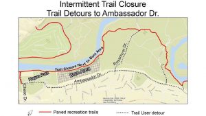
Lake Natoma bike trail still closed after 2017 rockslide

A popular bike and walkway on a stretch of the American River Parkway Recreation Trail is still shut down more than a year after a rockslide blocked it.

Heavy rains in 2016 and early 2017 made the already unstable cliffside on the north side of Lake Natoma worse. Then in January and February of 2017, large rocks and debris came crashing down.

“If you take a look at the hillside, there’s still a lot of very large fractures with large chunks of rocks that can still come down,” said Richard Preston, Folsom Sector superintendent of California State Parks, Gold Fields District. “So our plan is to try to scale, using techniques to bring those other rocks down before we clean up and repair the trail.”

Repairs were originally scheduled for Summer 2017. Initially, Caltrans was asked to assist, but Preston said they didn’t have the the staff, time or geological expertise.

More at KCRA.com >>>

Snowpack well below average

While the recent storms brought an abundance of fresh snow to the sierra, don’t expect Mother Nature’s generosity to instantly raise the level of Folsom Lake and other area reservoirs. On Monday, March 5, officials from the Department of Water Resources revealed that totals are still well below average.

Monday’s snow survey at Phillips Station reflected a dramatic change from February’s totals. However, the snow water equivalent (SWE) was 9.4 inches, which translates into the simple fact that our snowpack is a mere 39 percent of average for early March.

“California has unquestionably experienced a dry winter this year, with a near-record dry February,” said DWR Director Karla Nemeth. “While we’re happy to kick off March with this healthy storm, the variability of this winter’s weather patterns underscores the importance of continued conservation and the ongoing need to strengthen California’s water supply reliability for our people, our economy, and our environment.”

The snow survey conducted Monday by Frank Gehrke, chief of the California Cooperative Snow Surveys Program, was the second measurement at Phillips Station for this snow survey period. On Feb. 28, the snow survey found a SWE of 1.7 inches, just 7 percent of average for that time of year as recorded since 1964. Given the forecasted storm, officials conducted a second measurement on March 5 to record its impact, which yielded a 32 percentage-point increase in SWE over the previous week.

More at FolsomTelegraph.com >>>

Body of acclaimed rowing coach recovered from Lake Natoma

The body of Granite Bay resident and renowned rowing instructor John Hooten Jr. has been retrieved from Lake Natoma, where he went missing Monday.

Hooten, 66, was navigating a single rowing shell across Lake Natoma when he suddenly fell overboard about 10:50 a.m. Monday. A friend rowing nearby jumped out of his boat and tried to rescue him as he flailed in the water, but was too late.

Rescue crews from the Sacramento County Sheriff’s Department, California State Parks, California Highway Patrol, Sacramento County Office of Emergency Services, Sacramento Metropolitan Fire District, Drowning Accident Rescue Team (DART) and other public and volunteer organizations searched Nimbus Flat for Hooten’s body in dark, cold, relatively slow-moving water before finding him Tuesday evening.

More at SacBee.com >>>

Man Missing After Falling Out Of Boat On Lake Natoma

Multiple search boats are on Lake Natoma Monday after a man was spotted falling into the water from a boat and didn’t come up.

Around 10:50 a.m., the man described in his 60s was in a rowboat on Lake Natoma when he fell in and went under the water. He never resurfaced, a witness told a Sac Metro fire spokesman.

The man was not wearing a life jacket when he fell in.

A DART boat and Metro Fire Department boats are searching for the man.

The water where the man fell in is 30 feet deep and murky, says the spokesman.

From >>> CBSLocal.com

Nimbus Basin will be Closed to all Fishing as of March 2018

The Nimbus Basin on the lower American River will permanently close to all fishing as of March 1, 2018, as per fishing regulations amended by the Fish and Game Commission in December 2017.

The closure will take effect from Nimbus Dam on the lower American River to the U.S. Geological Survey (USGS) gauging station cable crossing approximately one-half mile downriver (California Code of Regulations Title 14, sections 7.50(b)(5)(A) and (B).

Under current regulations, the American River from Nimbus Dam to the Hazel Avenue bridge piers is open to fishing all year (CCR Title 14, section 7.50 (b)(5)(A)), and from the Hazel Avenue bridge piers to the USGS gauging station cable crossing about 300 yards downstream from the Nimbus Hatchery fish weir from Jan. 1 through Aug. 15 (section 7.50(b)(5)(B)).

Closure of the Nimbus Basin to fishing is part of the Nimbus Hatchery Fish Passage Project, which involves reorienting the hatchery’s fish ladder into the Nimbus Basin and removing the existing fish weir. This project will create and maintain a reliable system of collecting adult salmon and steelhead broodstock for the hatchery and increase the amount of natural spawning and rearing habitat available in the lower American River.

The changes will also minimize American River flow fluctuations associated with installation and removal of the hatchery’s weir and eliminate health and safety concerns relative to the deterioration of the existing weir structure. The new spawning habitat opened up by the permanent removal of the weir will improve juvenile salmon production and increase harvest opportunities downstream.

The U.S. Bureau of Reclamation and the California Department of Fish and Wildlife completed a joint Environmental Impact Statement/Environmental Impact Report (EIR/EIS) for the Nimbus Hatchery Fish Passage Project in 2011. Planning is currently underway and construction is scheduled to begin in federal fiscal year 2019. The EIR/EIS is available for download fromwww.usbr.gov/mp/ccao/hatchery.

Nutria Discovered in San Joaquin Valley; CDFW Seeks to Prevent Further Spread and Infestation

The California Department of Fish and Wildlife (CDFW) has become aware of a population of invasive nutria (Myocastor coypus) reproducing within the San Joaquin Valley. Given the severity of potential impacts and the impacts realized in other infested states, CDFW believes early intervention actions could be successful in eradicating nutria from the area and is asking the public’s help in looking for and reporting nutria sightings in order to determine the extent of the infestation.

To date, nutria have been found in wetlands, rivers, canals and other freshwater habitat in Merced, Fresno and Stanislaus counties. If allowed to establish, nutria will severely impact California’s resources, causing the loss of wetlands, severe soil erosion, damage to agricultural crops and levees and reduced stability of banks, dikes and roadbeds, as they have done in Louisiana, Chesapeake Bay and the Pacific Northwest. Nutria also degrade water quality and contaminate drinking supplies with parasites and diseases transmissible to humans, livestock and pets.

Native to South America, nutria are large, semi-aquatic rodents that reach up to 2.5 feet in body length, 12-inch tail length and 20 pounds in weight. Nutria strongly resemble native beaver and muskrat, but are distinguished by their round, sparsely haired tails and white whiskers (see CDFW’s Nutria Identification Guide). Both nutria and muskrat often have white muzzles, but muskrats have dark whiskers, nearly triangular (laterally compressed) tails and reach a maximum size of five pounds. Beavers have wide, flattened tails and dark whiskers and reach up to 60 pounds.

Female nutria are reproductive by six months of age, breed year-round, and can produce three litters in 13 months. Within approximately one year of reaching reproductive maturity, one female nutria can result in more than 200 offspring, which can disperse as far as 50 miles.

Nutria are destructive, wasteful feeders that destroy up to 10 times the vegetation they consume. Signs of presence typically include cut, emergent vegetation (e.g. cattails and bulrushes), with only the base portions eaten and the stems left floating. Nutria construct burrows with entrances typically below the water line, though changing water levels may reveal openings. Similar to other aquatic mammals, nutria often create runs, or paths in and out of the water or between aquatic sites. Nutria tracks have four visible front toes and, on their hind feet, webbing between four of five toes. Tracks are often accompanied by narrow tail drags.

Since March 30, 2017, more than 20 nutria, including males, pregnant females and juveniles, have been documented within private wetlands near Gustine, duck clubs, the Merced River near Cressey, adjacent to the San Joaquin River near Grayson, south of Dos Palos, the San Luis National Wildlife Refuge, and Salt Slough on the San Joaquin River. The full extent of the infestation is not yet known.

A multiagency Nutria Response Team, which includes representatives from CDFW, the California Departments of Food and Agriculture, Parks and Recreation, and Water Resources, the U.S. Department of Agriculture, the U.S. Fish and Wildlife Service and local county agricultural commissioner offices, has convened with the goal of eradicating nutria from the state. The response team is currently preparing an eradication plan, the first stage of which is determining the full extent of the infestation. Assistance from local landowners and the public throughout the Central Valley, Sacramento-San Joaquin Delta and beyond is critical to successfully delineating the population.

Suspected observations or potential signs of nutria should be photographed and immediately reported to CDFW’s Invasive Species Program online, by e-mail to invasives@wildlife.ca.gov, or by phone at (866) 440-9530. Observations on state or federal lands should be immediately reported to local agency staff at that land. CDFW has a nutria webpage and a downloadable PDF with photos and detailed descriptions of these rodents, their preferred habitat and the environmental threats they present.

E. coli levels in the lower American River are still unsafe. Will this new testing help?

The lower American River continues to be contaminated with potentially harmful levels of bacteria, water regulators said this week, and they are taking steps to pinpoint the sources in an effort to protect the waterway and the public.

Beginning this summer, staffers from the Central Valley Regional Water Quality Control Board will launch a yearlong study using sophisticated DNA testing to determine the sources of E. coli bacteria that have been found at levels higher than federal regulators recommend for safe recreational use of waterways. The sources of contamination are unknown, but likely include human waste from homeless camps, sewer overflows, wildlife and domestic dogs, officials said.

The testing will show what percentage of the bacteria is from people versus animals and birds, and whether it contains potentially dangerous pathogens such as giardia, salmonella and Hepatitis A, said Adam Laputz, the board’s assistant executive director. The study is expected to cost $300,000 to $400,000.

Information gathered by the agency will help county health officials determine the level of risk to people who use the river for boating, swimming, kayaking, fishing and other recreational activities, Laputz said. It also will help authorities figure out ways to reduce bacteria levels in the waterway.

More at SacBee.com >>>