Category Archives: Wildlife

Feds May Have Harmed Sacramento River Salmon

The federal agency that regulates water releases from the Shasta Dam in Northern California drastically cut those releases in November, and one fisheries group is afraid that the move could have killed millions of eggs laid by fall-run chinook salmon in the Sacramento River below the dam.

According to the Golden Gate Salmon Association (GGSA), the U.S. Bureau of Reclamation (BuRec) cut releases from Lake Shasta from 6,000 cubic feet per second (CFS) to 3,750 CFS between November 1 and 25. This caused river levels downstream to drop dramatically, which means that any salmon eggs laid in parts of the river that died up will almost certainly be lost.

This isn’t the first year BuRec has cut November water releases from the dam, and those cuts have hurt salmon in previous years. As many as 15 percent of the Sacramento river’s fall-run eggs were lost after a similar move in 2012, and almost a quarter of the run’s 2011 eggs were killed the same way, according to GGSA.

More at KCET.org >>>

Why do Pacific Salmon Die After Spawning?

The upriver salmon run is one of nature’s great migrations. Each year mature salmon make the long journey back to their natal river to reproduce, just once. For the five species of Pacific salmon (Chinook, chum, coho, pink, and sockeye), this arduous journey is a race against the clock that ends in a fleeting romance and ultimately death.

The answer to why they die, it turns out, hinges on a problem every animal on Earth has had to solve.

“Every kind of organism has evolved to solve the problem of balancing how much energy to put into surviving to first reproduction and how much energy to put into surviving to reproduce repeatedly,” said Steve Lindley, the director of NOAA’s Fisheries Ecology Division.

“Salmon are one of the extreme cases where they put everything into reproducing just once, and then getting old and dying almost immediately thereafter (a common strategy among insects but much less so for vertebrates).”

The reason for this, Lindley suggested, has to do with the difficult upriver migration salmon make back to their own spawning location. Flipping their bodies in the air and hurling themselves against the downward flowing water is no easy feat and one that is energetically exhausting. Because of this, salmon must fully develop in the ocean and build up fat reserves. Once they enter the river there is little food to eat and they stop investing in the maintenance of their bodies.

“The proximate reasons have to do with DNA switches,” Lindley said. “Essentially many of the activities that operate in immature salmon to allow them to maintain their health, grow and mature are turned off after maturation, and without maintenance they pretty rapidly ‘fall apart’.”

An alternative for these salmon species would be to spend more time in the ocean, accumulating food and energy so they are then able to migrate back after spawning. But this increases their risk of dying before getting the chance to spawn and for Pacific salmon, this is a risk too great.

From BayNature.org >>>

Prescribed Burns in Tahoe National Forest

The Tahoe National Forest American River Ranger District has begun its fall prescribed burn program. Fall and winter burning will include roadside hand piles, large machine piles, and up to 450 acres of underburning.

The exact timing of burns depends on specific fuel moisture and weather requirements designed to reduce the possibility of escape, manage smoke concerns, and ensure the best possible conditions for fuel consumption.

Burning is scheduled to occur in the following areas: Foresthill Divide; Humbug Ridge; the Sailor Point area off the Texas Hill Road; and Last Chance. Because smoke may cause diminished visibility during burning operations, forest visitors should stay alert for signs warning of prescribed burning or smoke obscuring the road. People traveling through a prescribed burn area should turn on headlights and be aware that burn personnel may be working along the road.

District fire managers work with the Redding Fire Weather Center and Placer County Air Pollution Control District to plan the prescribed burns to minimize smoke impacts to communities. However, some smoke may settle into the valleys during the evenings and mornings until atmospheric conditions allow for smoke dispersal.

For questions concerning the fall burn program, please contact fire management staff at the American River Ranger Station in Foresthill by calling (530) 367-2224. Daily updates can also be obtained at (530) 367-2224 as the burn program progresses.

For more Tahoe National Forest information, go to http://www.fs.usda.gov/main/tahoe/home.


Volunteers sought to repair trails damaged by American fire

Tahoe National Forest officials have reopened parts of two popular trails damaged in August by the American fire and are seeking volunteers to help rehabilitate the remaining trail segments.

The Western States Trail is open between Michigan Bluff and Deadwood Cemetery, and OHV Trail Loop 6, also known as Forest Service Trail 11E44, is open west of Deadwood Ridge Road.

The entire fire area, including all trails and roads within it, will remain closed for public safety until May 1, said Gwen Ernst-Ulrich, forest spokeswoman.

The fire, northeast of Foresthill in Placer County, burned 27,440 acres within the forest’s American River Ranger District and surrounding properties, including three historic buildings at the Pacific Slab mine.

Eighteen of the 25 miles of the Western States Trail damaged by the fire have been rehabilitated, Ernst-Ulrich said, and efforts are underway to winterize the remaining seven miles to minimize erosion.

Since 1974, the trail has been the site each June of the internationally known Western States 100-Mile Endurance Run from Squaw Valley to Auburn and, in August, the Tevis Cup Endurance Ride.

The remaining damaged seven-mile segment, between Last Chance and Deadwood, is listed on the National Register of Historic Places. It includes two fire-damaged bridges across the northern portion of the middle fork of the American River canyon.

“The (ranger) district is looking at alternate routes for these events if the swinging bridge that crosses the river is not able to be used in time,” Ernst-Ulrich said. “Thousands of other recreationists use this popular trail annually.”

More at SacBee.com >>>

Forest service officials assess trails in American Fire area

American_Fire

Now that fire activity within the American Fire area has diminished, Tahoe National Forest officials have assessed conditions on two popular trails: the Western States Trail and OHV Trail Loop 6, also known as Forest Service Trail 11E44 (Loop 6).

The Western States Trail between Michigan Bluff and Deadwood Cemetery is open, and Loop 6 is open west of Deadwood Ridge Road. The entire fire area, including all roads and trails, is closed under Forest Order 17-13-08, which is in effect until May 1, 2014.

Therefore, the Western States Trail and Loop 6 within the fire area east of Deadwood Ridge Road remain closed. These trails will be returned to acceptable standards before being considered safe for recreationists.

The American Fire affected approximately 25 miles of the trail. To date, roughly 18 of those miles have undergone rehabilitation through fire suppression and/or burned area emergency rehabilitation efforts.

More at TheUnion.com >>>

1964 Highway 49 Bridge Rubble Remains A Cleanup Quandary

HWy49Bridge

By most accounts, the Highway 49 bridge blowout of December 1964 was spectacular.

The Dec. 23, 1964, bridge washout put traffic on the Mountain Quarries Railroad Bridge for four months, and a new Highway 49 bridge was in place by spring of 1965. That year was also when the Auburn dam project was authorized by Congress. Though the dam was never built, the possibility that it would be constructed left the option of doing nothing open. The downstream rubble and steel the washout left behind would soon be under hundreds of feet of water.

Almost 50 years later, the dam has yet to be built and the remains of the bridge have yet to be cleared away – leaving a quandary for several levels of government, as well as environmentalists advocating greater use of the Auburn State Recreation Area as a park.

During fall days like Wednesday, when the American River flows are down to their lowest levels of the year, the mangled steel can be seen clearly in the river bed, some of the pieces poking up above the water line. The broken concrete – giant gray chunks weighing several tons – litters the canyon shoreline.

Elias Silver of the Lake Tahoe area was at the shoreline skipping stones with friends as their dogs romped in the calm, meandering waters at the confluence below the newer Highway 49 bridge.

“It’s definitely noticeable,” Silver said. “With all the state budget problems, it would be expensive to fish out. It’s not a small project.”

More at FolsomTelegraph.com >>>

Salmon leap at a chance to spawn at hatchery

With a swish of its tail, a salmon jumps more than 20 steps – one at a time – to the top of the Nimbus Fish Hatchery ladder Monday as the annual fall migration takes place. Nikolai Andryhoushkin, pictured, of Sacramento photographs the event, vital to the survival of salmon and steelhead in the lower American River.

Once they make their way up the fish ladder, the salmon are sorted and spawned on a table. An average salmon female has more than 5,000 eggs. The eggs are housed in the spawning building and the fish are raised until they are 4 to 6 inches long before being released. Steelhead are also raised at the hatchery, just off Highway 50 in Rancho Cordova.

Since 1958, the Nimbus Fish Hatchery has been successfully providing mitigation for the loss of natural fish habitat in conjunction with the U.S. Fish and Wildlife Service, the state Department of Fish and Game and the U.S. Bureau of Reclamation.

More at SacBee.com >>>

Salmon ladder opens at Nimbus Hatchery on Monday

Chinook_Nimbus

The fish ladder at Nimbus Hatchery on the American River opens Monday, and salmon are reportedly piling up waiting to use it.

The Chinook salmon run is an annual spectacle on the American River as the giant fish return each fall from the ocean to spawn. This year, the run that continues into December should be noteworthy, because the salmon population is expected to rebound significantly from recent lows.

The fish ladder leading to the hatchery is a great place to view the run, and visitors can stand alongside the ladder while the big salmon jump into the hatchery. The ladder is scheduled to open at 10:45 a.m. Monday.

“There will definitely be fish,” said Andrew Hughan, a spokesman for the California Department of Fish and Wildlife, which operates the hatchery.

More at SacBee.com >>>


Researchers say California salmon experiment a success

Flooded rice fields appear capable of serving as substitutes for now-depleted wetlands and helping California’s Chinook salmon population recover, researchers have concluded.

In a report submitted to the U.S. Bureau of Reclamation, the researchers said salmon raised in replicated rice fields near Sacramento as part of their experiments were the fattest and fastest-growing salmon ever documented in freshwater in the state.

“We’re finding that land managers and regulatory agencies can use these agricultural fields to mimic natural processes,” study co-author Carson Jeffries, field and laboratory director of the University of California, Davis’ Center for Watershed Sciences, said in a news release on Thursday.

The state Department of Water Resources and a nonprofit called California Trout also participated in the report, which is dated Oct. 1.

Juvenile Chinook salmon in California’s Central Valley have traditionally been reared in wetlands, where they fatten up before heading off to the ocean. A salmon’s size is an indicator of its likelihood of returning to spawn as an adult, according to the study.

The goal of the researchers’ experiment was to determine whether rice fields flooded between harvests could stand in for the wetlands that once filled the area.

More at MercuryNews.com >>>

Dry October doesn’t help reservoir water levels

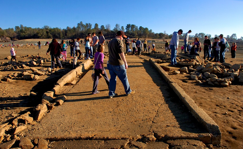
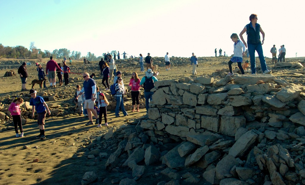
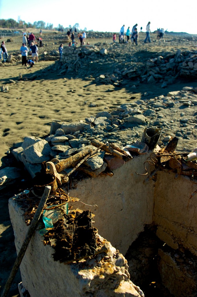
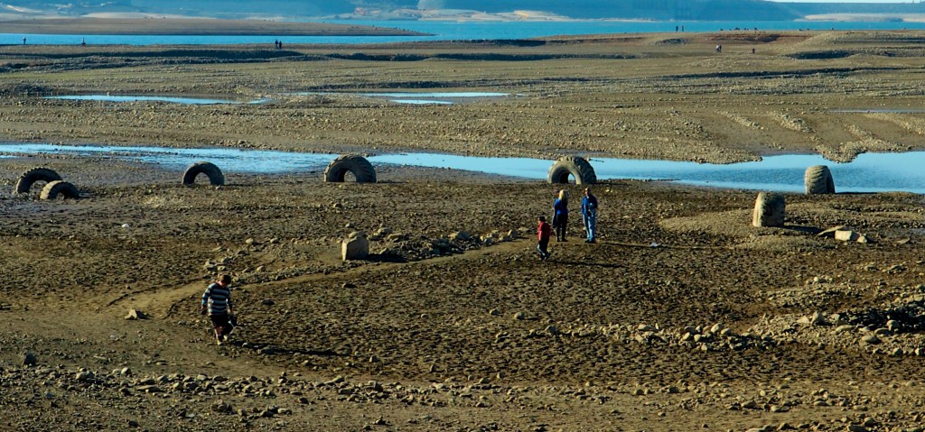
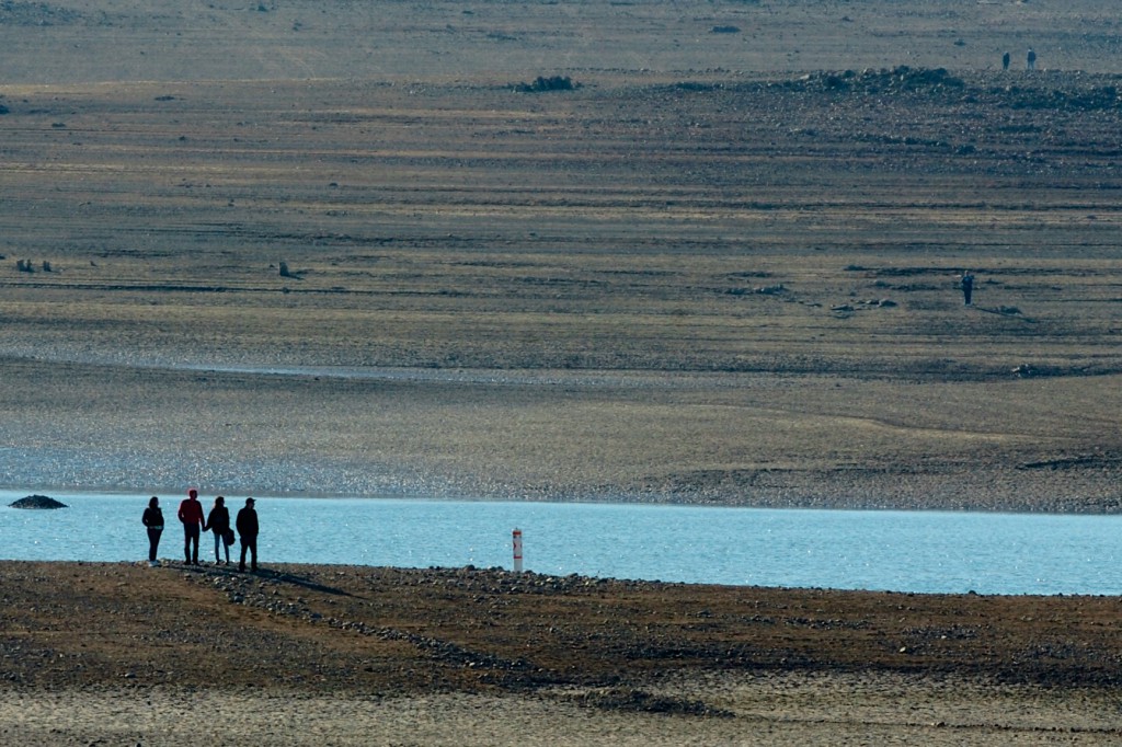
With docks perched on sand and vehicles parked where buoys once floated, anyone heading out to Folsom Lake can see right away that the water level is low.

“We’re getting dangerously low,” said a fisherman who was out at the Lake Tuesday.

The reservoir, which is used for municipal and industrial purposes, is 11 percent lower than is was this time last year, according to the Department of Reclamation.

“Last year we were at about 42 percent of capacity, this time of year; this year we are at about 33 percent in Folsom,” Department of Reclamation’s Lewis Moore said.

Moore said it’s not just Folsom where water levels are low. because of back-to-back below average annual precipitation amounts, all of the region’s reservoirs have dropped from 57 percent capacity last year down to 41 percent this year.

More at News10.net >>>