Category Archives: News from Other Watersheds

News from other watersheds.

California Nerodia Watch

Nerodia Sipedon
Let’s hope we don’t get more Nerodia in the American River watersheds! Please report any sightings.

Nerodia Watch enlists citizen scientists to report sightings of Nerodia watersnakes in California. Nerodia threaten California’s native fish and wildlife species through predation and competition for resources. Their fast rate of population growth, ability to disperse overland to new habitat, and close proximity to special status species causes great concern for California’s native fish and wildlife species. This campaign is intended to monitor for the spread of existing populations, prevent the establishment of new populations, and facilitate rapid response management efforts to control or eradicate Nerodia watersnakes in California.

Currently, N. sipedon is established in Roseville (Placer County) and N. fasciata pictiventris is established in Folsom (Sacramento County) and Machado Lake (Los Angeles County). Areas that should be targeted for surveying include most types of permanent freshwater habitats, such as ponds, wetlands, canals, and slow-moving streams and rivers. Specific locations of interest include in and around Roseville, Folsom, the lower American River, the Sacramento River watershed west/southwest of Sacramento, Stone Lakes National Wildlife Refuge, Little Potato Slough, French Camp, the Sacramento-San Joaquin Delta, and Los Angeles County.

For more information on Nerodia watersnakes in California, visit CDFW Invasive Species Program – Species profiles, The California Nerodia website, the Stop the Spread of Non-Native Water Snakes in California Facebook group, and CaliforniaHerps.com.

In 2008, all Nerodia watersnake species were added to the California Department of Fish and Wildlife’s list of restricted live animals, making it illegal to possess, transport, or import them into the state without a restricted species permit from the Department of Fish and Wildlife.

A Short Run for Some California Whitewater Rivers This Season

Justin Butchert drops bags of ice into huge coolers and lifts them onto his pickup truck.

“This is our only form of refrigeration up there,” says Butchert, owner of Kings River Expeditions.

He’s referring to his company’s base camp on the Kings River, east of Fresno in the Sierra Nevada. The outfit has run overnight trips, complete with cookouts and goofy campfire skits, for more than 30 years.

But this is the first time in 25 years he’s packed the food.

“You know I just do everything now,” he says. “We used to have a full staff doing this and we don’t have that anymore.”

He has the same number of employees, but they’re working fewer hours. In the best of years, his company stays open until Sept. 1 and guides about 6,000 folks down miles of roaring rapids.

More at KQED.com >>>

New Study Identifies Roadkill Hotspots In Sacramento Region

A detailed inventory of animals killed on area roads has identified 22 areas in the Sacramento region where drivers are most likely to encounter wildlife crossing a roadway.

The release of the report on roadkill hotspots is considered a crucial tool to help drivers avoid possible fatal accidents and is being seen as a guide for scientists and agencies who seek to protect endangered species and other wildlife that cross roads and freeways.

The report, authored by Fraser Shilling of the UC Davis Road Ecology Center, culled volunteer observer reports of such incidents from 2009-2014 to establish where collisions between cars and animals were occurring.

The region’s hotspots include several points along Interstate 80 and and I-5. One is a stretch of I-80 over the Yolo Bypass where bird strikes are common.

Another is a stretch of I-80 where the freeway and Highway 49 converge in Auburn near the American River, “where there is no opportunity to go under the highway,” said Shilling, “so wildlife will go over it.”

Between April 1, 2010, and March 30, 2013, there were 365 crashes involving wildlife, livestock and other animals in the state Department of Transportation’s District 3, said Caltrans spokesman Mark Dinger. The district includes Sacramento and 11 Northern California counties, covering I-80 from Davis to the California/Nevada state line and I-5 from north of Stockton to north of Orland.

Statewide, Caltrans inventoried 3,126 reported collisions involving animals, Dinger said.

One human fatality in Sacramento County has been attributed to a wildlife collision since 2006.

Shilling said the roadkill report was compiled with the help of 1,100 volunteer observers throughout the state, including himself. The survey is the most extensive database documenting animal and vehicle collisions in California.

“Last year it seems like there has been an increase in rate of deer getting hit,” said Shilling. He said observation of deer hit by autos more than doubled last year.

He speculates that the drought may have something to do with it.

“They’re moving around more,” said Shilling. “They get moisture from vegetation, and they were probably having a hard time getting enough to eat.”

Despite the increase in deer mortality, roadkill observations overall have gone down slightly this year, said Shilling.

He believes the decline is not reflective of animals avoiding roadways. Instead he believes that roadways are decreasing wildlife populations, resulting in fewer roadkill observations.

The roadway hotspot with the most animal deaths is State Route 70 near Portola Valley. That stretch of road had 343 animals from 25 species killed in the roadway.

Shilling said that the numbers are deceptive, as the large majority of encounters between cars and animals go unreported.

The actual mortality on freeways and highways and streets is “much, much higher than this report represents,” said Doug Long, one the most prolific observers contributing to the database, with more than 3,000 roadkill observations logged since the effort began six years ago. Long is professor of ecology and biology at St. Mary’s College.

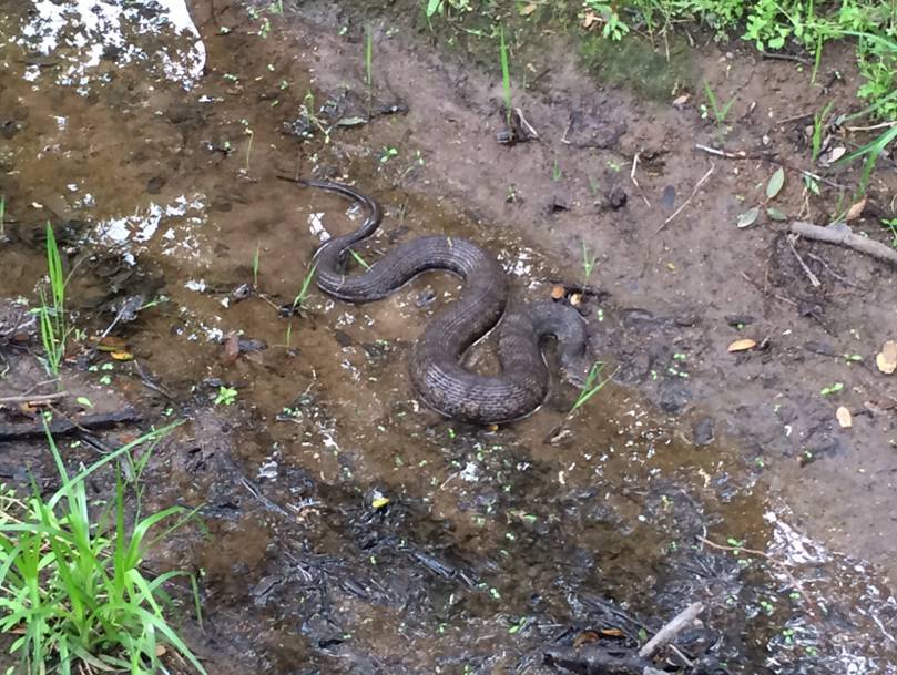
During a drive from Riverside to Oakland, Long used a special application on his phone to log 80 different species of roadkill he encountered on the drive. These include a wide variety of species – from snakes to birds, he said.

“You have to remember that the data points in the report have been collected by people (who) represent a very small fraction of all the people in California,” said Long.

Long said it is likely that 99 percent of encounters between wildlife and vehicles are never recorded.

More at SacBee.com >>>

Spring To Arrive Rain-Free In Sacramento And North State, Much Like Winter

The official arrival of spring today brings with it the realization that Sacramento and the Sierra Nevada have again been abnormally dry for the fourth straight winter.

The rainy season began in the fall with hope that the drought would be broken, but that was not to be.

With the exception of one big “Pineapple Express” in December and a good rain in February, Sacramento has been dry – and, lately, warm.

On Thursday, Sacramento set a record when the high temperature reached 81 degrees at Executive Airport, topping the previous mark of 80 degrees set in 2004, according to the National Weather Service.

The lack of rain was especially stark in usually soggy January when just 0.01 of an inch was recorded in Sacramento.

The winter also did not deliver a great deal of snow to the Sierra Nevada. California’s water supplies are reliant on mountain snowpack that melts in the spring and fills reservoirs for summer use in cities and on farms.

The most recent snowpack survey showed that statewide the mountains have just 13 percent of the snowpack normal for this time of year.

“Generally our snowpack accounts for about a third of our state water supply,” said Brooke Bingaman, weather service meteorologist. “Not all of the 13 percent snowpack will end up in the reservoirs, some of it will soak into the ground. So the level our reservoirs are at now is essentially what we will have for the rest of the summer.”

The culprit behind the snowfall shortfall is a familiar meteorological villain – a high-pressure ridge that has shunted snowy storms to the north, Bingaman said.

In addition, the northern part of the state usually gets five to seven atmospheric rivers, large storms that can drop several inches of rain. This year, Sacramento got two such storms.

One hit in December, a month when 7.63 inches fell and another in February, when 2.28 inches of rain were recorded.

“Since Oct. 1, we have had 11.73 inches,” Bingaman said. “Normally we should have had 16.64. So we are at 70 percent of normal right now.”

Bingaman said Folsom Lake is 59 percent full, but it won’t get the usual snowmelt from the American River.

“December, January, February and March are typically our wettest months of the year,” she said. “Really, December was the only month that was really wet.”

More at SacBee.com >>>

Feds Quietly Double Allowable Kill of Endangered Delta Fish

Just days after the California Department of Fish and Wildlife reported the worst season in history for the federally Endangered delta smelt, the U.S. Fish and Wildlife Service quietly gave permission in early January for Central Valley water projects to kill more than twice as many smelts at their intake pumps this year.

The state wildlife agency reported January 7 that just eight delta smelt were found in more than 400 fish sampling trawls across the Sacramento Delta in the previous four months, fewer than half the number found in the previous all-time worst year for the smelt, in 2009.

Two days later, USFWS boosted the number of delta smelt it would allow the state and federal water agencies to kill at aqueduct intake pumps in the Delta from 78 to 196 adult smelt. That means those agencies have permission to kill more than 24 times as many delta smelts as the state’s wildlife agency could find last fall.

On January 9, the U.S. Bureau of Reclamation reported to USFWS that intake pumps for the federal Central Valley Project and for the State Water Project had killed 56 adult smelt during the current Water Year, which started October 1. The USFWS’ Biological Opinion on the smelt for the combined projects allowed “incidental take” of 78 adult fish.

As those projects’ pumps had killed more than half their allowable take of smelts just a third of the way into the water year, the Bureau was obliged under the U.S. Endangered Species Act to request what’s called “reconsultation” with USFWS over the smelt. Otherwise, pumping of all water from the Delta to southern aqueducts could be halted once that 78th smelt of the year died.

It didn’t take long for the Bureau of Reclamation to get a response. USFWS boosted the allowable incidental take for the Bureau, and for the state Department of Water Resources, which operates the State Water Project, the very same day. Those agencies now have an “interim” allowable incidental take more than twice as high as the level specified in the Biological Opinion.

In granting the increase in allowable take, USFWS pointed to criticism of the assumptions behind the earlier take limit’s numbers by an independent review panel, which pointed out that there was no clear way of establishing how big a percentage of the actual total smelt population was being killed at the pumps each year.

In its response to the Bureau, USFWS says it plans to come up with a more accurate way of estimating just what percentage of the delta smelt population is being killed at the pumps.

More at KCET.org >>>

Questions Surfacing On Lake Clementine Hydro Project

Questions are being raised by several Auburn-area residents about a proposal to build a hydroelectric generation facility at the North Fork Dam at Lake Clementine.

Speakers at a public session Monday on the privately funded project wanted to know about its effect on downstream recreation, potential drops in scenic flows over the dam and other potential impacts.

About 25 people attended the session at theCanyon View Community Center,  and the number of questions spurred the project proponent to schedule a special meeting at 6 p.m. Aug. 26 to provide an overview of the project and address queries.

Monday’s session was a public one but meant to concentrate on comments by government agencies and stakeholder groups about study plans by Los Angeles-based  American Renewables and Kruger Energy of Canada.

Project manager Dan Parker agreed to the question-and-answer session after a request for a separate meeting in the evening to allow Monday’s session with government agencies to move forward on time. The location for the Aug. 26 meeting has yet to be determined.

Answering a question Monday from Helga White of Auburn, Parker said that esthetic flows over and environmental flows to aid wildlife and plant life downstream would take precedent over power-generation flows. The picturesque dam was built in 1939 to hold back mining debris but allow river flows downstream.

The proposed 15-megawatt power-generation facility – designed to produce electricity to serve 3,000 households – is to be operated on a “run-of-the-river” basis. It would take advantage of higher flows in the rainy season and go offline in late July, August and September, when flows along the North Fork American River are low.

“We don’t get our water first,” Parker said. “We get our water last.”

Michael Garabedian of the Friends of the North Fork asked whether a survey was being planned – “not just conversations” – on canyon users’ reaction to the project. He was told a survey was planned on recreational use.

The original survey, conducted in 2006 by State Parks in the Auburn State Recreation Area, “didn’t show interest in this type of development or development of any kind, as I recall,” Garabedian said.

More at AunurnJournal.com >>>

Drought May Already Have Killed Off Central Coast Coho Salmon

As wildlife managers fret over the effects of the ongoing drought on California’s fish, some are saying that a particularly vulnerable population of salmon may already have been wiped out by the drought.

According to reporter Peter Fimrite in the San Francisco Chronicle, coho salmon cannot spawn in coastal creeks along the coast between San Francisco and Santa Cruz County because water levels are too low.

Stafford Lehr, chief of fisheries for the California Department of Fish and Wildlife, told Fimrite that the news for Central Coast coho salmon may be very bad indeed. “The Central Coast coho could be gone south of the Golden Gate.”

Coho salmon, Oncorhynchus kisutch, generally mass just offshore before spawning season, where they wait for winter rains to fill creeks sufficiently to allow them to swim upstream. This year, those rains never came, and the coho have been unable to make it past the sandbars at the mouths of their home creeks.

One watershed north of the Golden Gate does have enough water in it for coho to have made it upstream, reports Fimrite: the Lagunitas Creek watershed, home of the state’s largest run of wild, non-hatchery-raised coho. The Marin Municipal Water District has been stepping up releases of water from Kent Dam to help the coho out.

But even in Lagunitas Creek and its tributary San Geronimo Creek, biologists have only counted 57 of the gravel bed nests, or “redds,” in which female salmon lay their eggs. That’s not a record low: the disastrous 2009 spawning run consisted of just 26 redds. But it is down by half from last winter’s count, and well below the thousands of redds generally found in the watershed in the 1940s.

Coho that spawn in creeks between the San Lorenzo River in Santa Cruz and Punta Gorda in Humboldt County are considered a distinct population, called the Central California Coast Evolutionarily Significant Unit (ESU) by the U.S. Fish and Wildlife Service. With the legal status of a distinct species, the Central Coast Coho ESU is listed as Endangered under the federal Endangered Species Act.

A coho’s typical lifespan is three years from hatching to spawning. Most coastal streams will thus have three distinct cohorts of coho salmon that call it home. Young fish may stay in their home streams for up to a year and a half before heading downstream and out to sea. If the drought keeps fish that hatched last winter from reaching the ocean in addition to barring this year’s cohort from heading upstream to spawn, creeks between San Francisco and Santa Cruz stand to lose two of those three cohorts.

More at KCET.org >>>

Conservation Groups Object To Lack Of Fish Protection In YCWA Relicensing Application

While some groups are excited about what the Yuba County Water Agency’s FERC relicensing applications contains, other groups are lamenting what is missing — namely, provisions that address removing barriers to native spawning habitat for endangered fish.

Numerous conservation groups called for the YCWA to look into developing fish passage through, or removing entirely, Englebright Dam, which is a direct barrier to more than 120 miles of salmon habitat, according to comments submitted by the Foothills Water Network, which represents a group of water resource stakeholders in the Yuba, Bear and American River watersheds.

“The ultimate goal is to restore salmon to their native habitat,” said Tyrone Gorre, co-founder of the Sierra Salmon Alliance. “In order to restore habitat, we have to have passage through the dam.”

Chinook salmon and steelhead and rainbow trout are both native to the upper Yuba River watershed.

The problem with those requests is that the Englebright Dam is not within the FERC boundary of YCWA’s project and is operated by the Army Corps of Engineers.

“There’s not a connection between that dam and the FERC relicensing,” said Yuba County Supervisor Mary Jane Griego. “Some of the river agencies would like to connect those so there’s a requirement for us (to install fish passages), but the FERC relicensing really separates those issues.”

The Foothills Water Network said excluding Englebright from the relicensing process is a mistake, arguing that because YCWA operates its reservoir levels and releases, it should be included in their FERC license.

“We have maintained that fish passage is not part of our FERC relicensing. YCWA facilities don’t block fish passage; the major barrier is Englebright Dam,” said Curt Aikens, YCWA general manager. “We do realize that this is a significant issue in the Yuba watershed, and we’ve helped lead and facilitate different fish passage studies and programs.”

Aikens said the colder water released from the higher elevation of New Bullards Bar dam has helped improve salmon habitat in the lower Yuba River.

The salmon population has recovered since a stark decrease around 2007 caused a temporary halt in the salmon fishing industry, but reported numbers from the Yuba River in recent years are below those of the decades prior.

More at TheUnion.com >>>

Placer Water Has 2014 Supply Concerns

The Placer County Water Agency is saying that a good rainfall year is needed in 2014 to restock mountain reservoirs.

And the Water Agency is already looking at the possibility of water-use reductions.

The Auburn-based agency is expressing concerns as a very dry 2013 draws to a close. Tony Firenzi, deputy director of technical services, said a dry 2014 could cause problems.

“Right now, our water storage is at 90 percent of average for this time of year, so we’re in good shape for the time being,” Firenzi said, “but we’re very concerned about the continuing dry forecasts.”

Looking into the coming year’s projections, Firenzi said better-than-average precipitation would be needed to restore average storage levels on the upper Yuba-Bear and American river watersheds. Placer Water depends on the two watersheds for its surface water supplies.

Water storage in reservoirs that serve Water Agency customers has remained at or near average levels despite back-to-back unusual water years. The 2011-12 water year (measured from Oct. 1 to Sept. 30) was dry but ended near average after the so-called “Miracle March” in spring 2012. It was followed by a 2012-13 water year that produced near record precipitation in November and December 2012 but then turned unusually dry.

“In fact, the 2013 calendar year is on track to close as one of the driest ever measured, which is the basis for serious concern as we look ahead at water availability for 2014,” Firenzi said.

More at AuburnJournal.com >>>

Central Valley Salmon Runs Could Be Restored

Salmon advocates say they know how to restore sustainable salmon runs in the Central Valley – 26 different ways.

The Golden Gate Salmon Association says two years of study have resulted in a 26-project salmon rebuilding plan to reverse the steep decline of California’s four salmon runs, including two considered endangered and threatened under the Federal Endangered Species Act — the winter and spring runs.

The fall and late fall-runs, which support the sport and commercial fishery, declined by 90 percent and 87 percent respectively from 2001 to 2011, the association says.

“The salmon problems are not in the ocean but rather in the freshwater rivers where salmon reproduce and then try to migrate downstream through the many hurdles that exist on their journey to ocean waters,” says GGSA Chairman Roger Thomas.

The 26 projects are divided into three tiers to prioritize completion. In April the first eight high priority projects were selected with most underway or in the pipeline for 2014. The second tier is currently being considered by federal agencies for implementation.

The rebuilding plan can be broadly broken into two categories of projects, says the association. The first calls for better flows for salmon in the Sacramento and San Joaquin rivers and the Sacramento-San Joaquin Delta. The second are projects aimed at healing manmade structural impediments built in and along the rivers.

The loss of many baby salmon at the pumping facilities that divert water from the Delta for export south is another problem the GGSA says its plans address.

More at CentralValleyBusinessTimes.com >>>