Category Archives: History

Sacramento State Bridge To Soon Get Makeover

Everything around the Guy West Bridge is pleasing to look at. Everything but the bridge itself.

The slim and shaky footbridge crossing the American River at Sacramento State needs some love. Paint is fading and chipping on the towers, and the handrails need to be fixed. The city says it’s planning to spend more than $3 million on a makeover this summer, and crews are already out there getting ready.

“It’s worth it,” Pam Sechrist said. “It’s one of our landmarks and we need to keep it in shape.”

It was a cloudless, warm morning last week as Sechrist finished her daily walk over the bridge with Tess, her lively Jack Russell Terrier/Chihuahua mix. Waves of college students joined her, hurrying across the span to their 9 a.m. classes. Cyclists and joggers weaved through the traffic.

No one was looking at the bridge.

That’s too bad. When it was built in 1966, it was thought to be the longest pedestrian suspension bridge in the country. And it was designed to look like the Golden Gate Bridge.

The Golden Gate Bridge’s official color is “International Orange.” It is an unmistakable color, designed to create a connection between the striking bridge and the landscape around it.

The Guy West Bridge is supposed to be that same color. Instead, after years of fading, its coat looks more like the skin of an old Barbie doll.

Some have suggested painting the Guy West a brilliant yellow, like the city’s true landmark crossing, the Tower Bridge. Others have mentioned throwing in a touch of Hornet green to salute Sac State.

The city is sticking with the original shade of orange. If all goes well, the new paint job will be done by the fall, along with a touched-up deck and a revamped electrical system.

It’s a sizable investment as other projects around the city are slowly receiving attention. Nearby, the city has found the cash to pave a bike trail on the south shore of the American River between Sac State and Sutter’s Landing Park in midtown.

More at SacBee.com >>>

Read more here: http://www.sacbee.com/2014/05/19/6414147/sacramento-state-bridge-to-soon.html#storylink=cpy


Outdoors: Wealth Of New Information In American River Guidebook

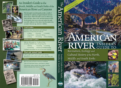
american_river_cover500

A ceramist by profession, and by passion, Eric Peach often leaves his home studio in Auburn to venture down into the American River Canyon, looking for inspiration in the rushing white water, the winding trails, the abundant wildlife and bountiful flora of a thriving ecosystem.

You can see the result in his works, ranging from playful river otters to fish sculptures to those psychedelically hued fire belly newts.

But you can also see Peach’s love for the American River and its foothills in bookstores and at outdoor retailers. The third edition of “The American River: Insider’s Guide to Recreation, Ecology and Cultural History of the North, Middle and South Forks” ($24.95, Protect American River Canyons, 416 pages) recently was released, all proceeds going to the nonprofit Protect American River Canyons, the organization that sponsors the American River Confluence Festival and other fundraising events.

Peach, 64, and wife Paula enlisted no fewer than 44 writers and editors, and 30 photo and graphics contributors, to completely revamp the second edition, published a decade ago. This time around, 15 trails were added, as were scores of new and updated rafting routes, including a new stretch from the confluence down to Rattlesnake Bar. There’s also a complete digest of plants and trees, birds, reptiles and mammals, as well as an exhaustive history of the area, from the Indian settlements up to the now-revived attempts to dam the river.

More at SacBee.com >>>

American River Flows At Lowest Level In 21 Years

Fishermen, bicyclists and hikers trudged along the American River on Saturday, surveying the historically low flows and wondering about the impact.

In response to extreme dry conditions, the U.S. Bureau of Reclamation cut water releases from Folsom Dam into the river gradually last week from 1,100 cubic feet per second to 500 cfs Friday. About half a million residents in suburban Sacramento rely on the dam for water.

The strict water-conservation measures have created the lowest flows anyone has seen in a generation, which stands in contrast to the median flow for January of 1,700 cfs for the past 15 years.

At William Pond Park, Carmichael native Amy Musial, 32, snapped a couple photos of the exposed rocks and islands.

“It’s crazy,” said Musial, who grew up playing in the river. “I’ve never seen it this low.”

Musial ventured out with her husband and 3-year-old son just to see the water level.

“We would be standing in a few feet of water here,” Musial said, “but not anymore.”

The last time American River flows were dropped to this level was in 1993, according to the Bureau of Reclamation, which operates Folsom and Nimbus dams on the river.

More at MercedSunStar.com >>>

Mormon Island Exposed

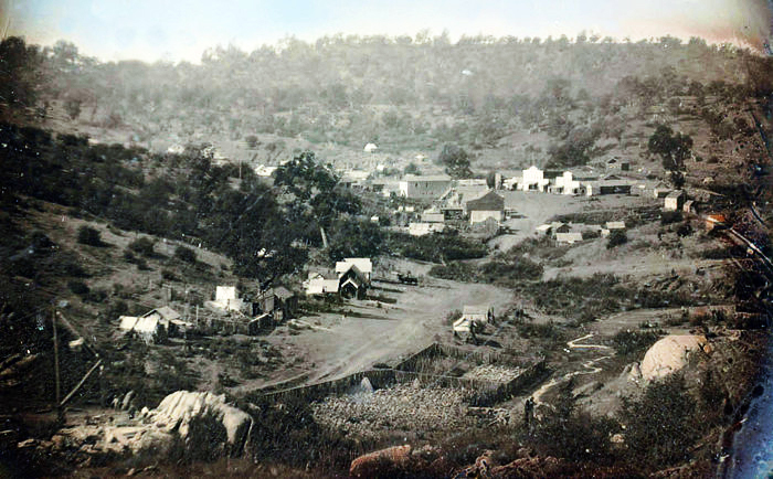
Mormon Island
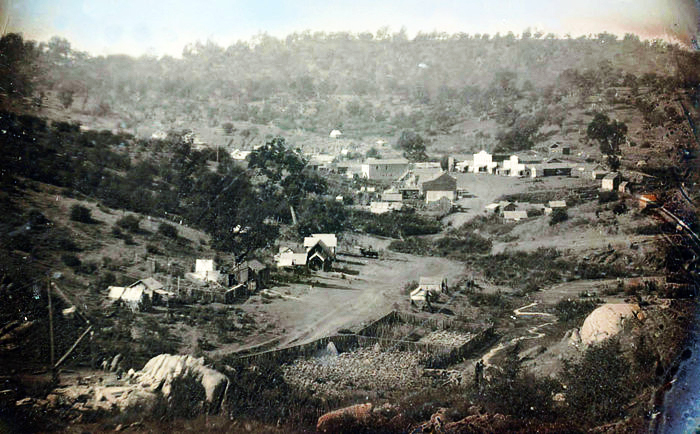
Undated Photo; Mormon Island

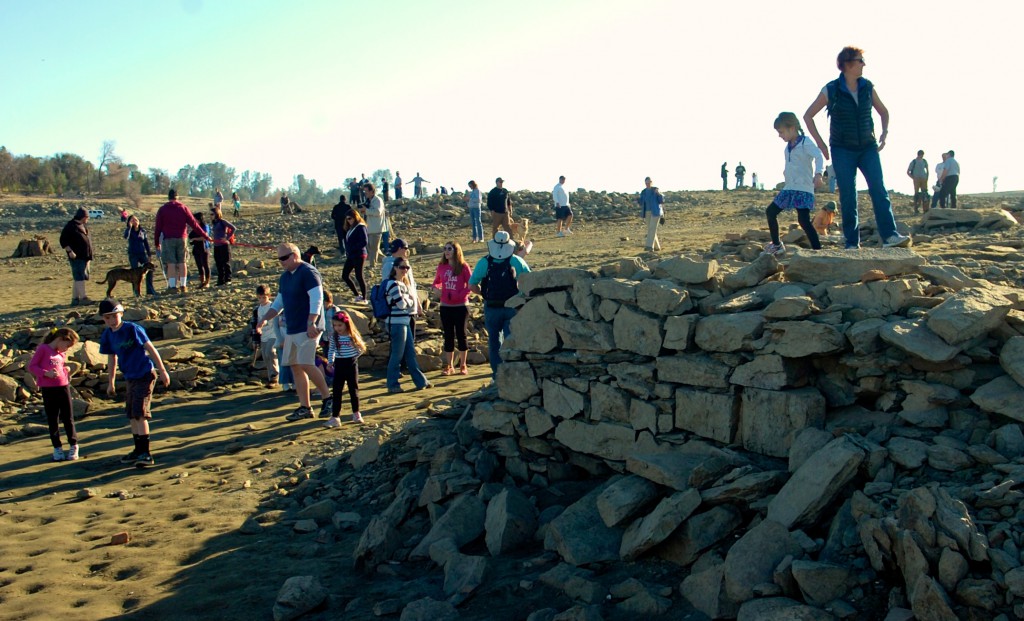
During the height of the gold rush Mormon Island was once a thriving gold mining camp. In its heyday, the town had 2500 residents (mostly Mormon), 4 hotels, 7 saloons, and 1 school.

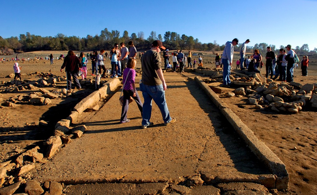
Exposed foundations and other artifacts draws hundreds of curious explorers. Photo: AmericanRiverWildlife.com

The town dwindled along with gold fever and by the 1950s there were no more than a few residents left. What was left of the town was eventually flooded in 1955 with the creation of Folsom Lake.

As California's drought continues more pre-dam artifacts are exposed by the receding water.
As California’s drought continues more pre-dam artifacts are exposed by the receding water.  Photo: AmericanRiverWildlife.com

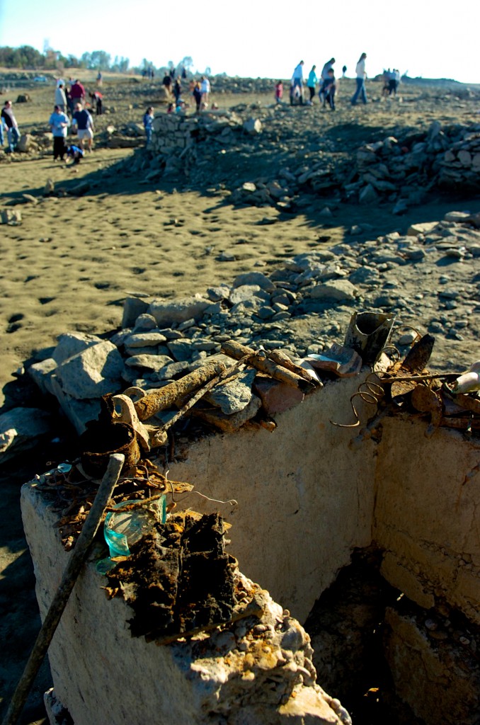
The only remnants of this town are sometimes visible during extreme drought years, as foundations of houses lie underwater.There is a relocation cemetery located south of the lake, where residents were moved before the lake was filled. A few unknown residents of Prairie City were also transported there when they were discovered during Intel’s onramp construction.

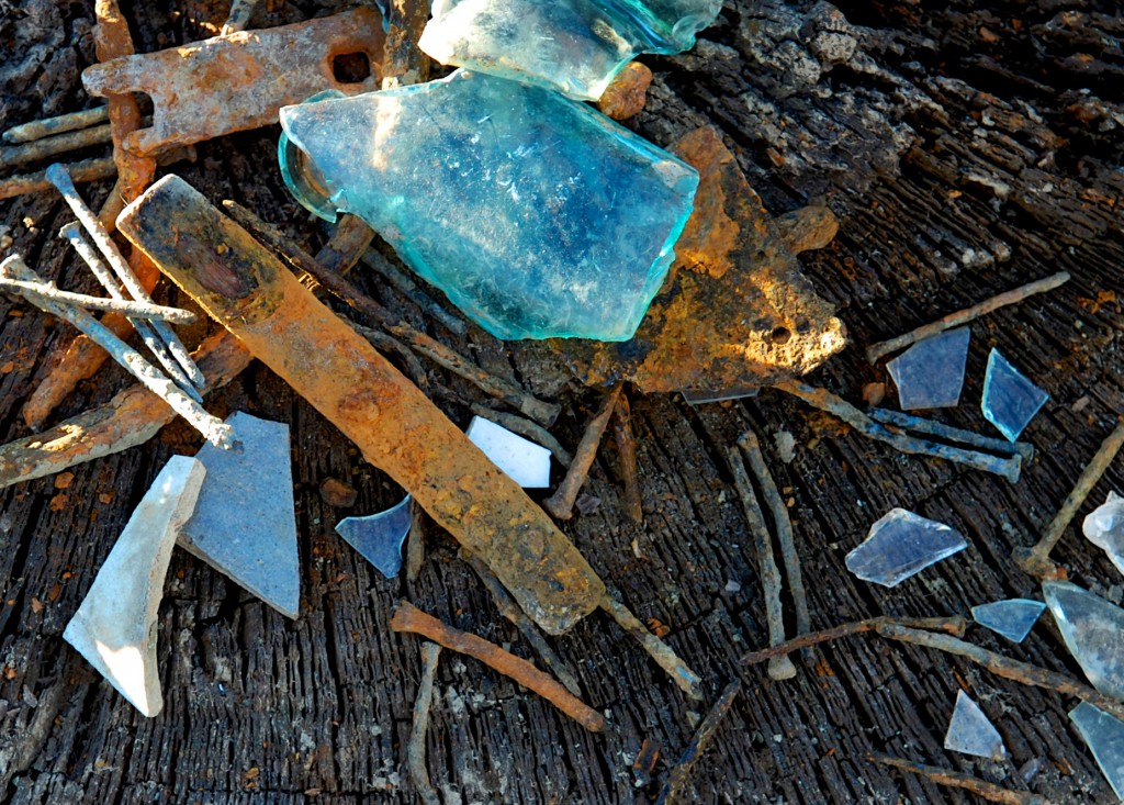
Rusty nails, fence parts, glass and other items are displayed on the exposed foundations of Mormon Island.
Rusty nails, fence parts, glass and other items are displayed on the exposed foundations of Mormon Island. Photo: AmericanRiverWildlife.com

Mormon Island was also known at the time as Mormon Diggins, Mormon Diggings, and Lower Mines.

Mormon Island artifacts.
Mormon Island artifacts. Photo: AmericanRiverWildlife.com
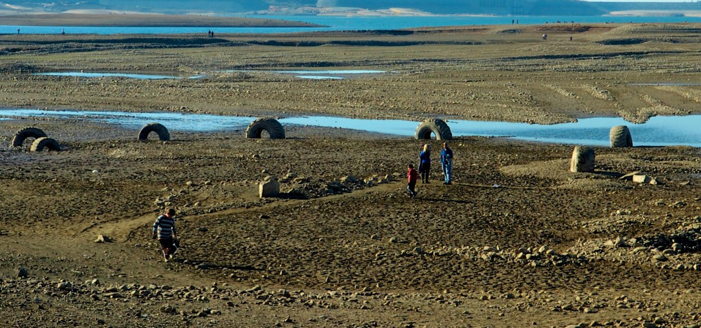
The lake bed near the Dyke 8 area of Folsom Lake show evidence of large scale construction.
The lake bed near the Dyke 8 area of Folsom Lake show evidence of large scale construction. Photo: AmericanRiverWildlife.com

If you go:

  • Everything you’ll see is state park property and it is illegal to remove it.
  • There’s a parking fee at most access points. State park info here: http://www.parks.ca.gov/?page_id=500
  • The Dyke 8 entrance off of East Natoma and Briggs Ranch gets you close to the water but not close to the artifacts.
  • Brown’s Ravine is the most popular parking spot and offers a short hike to the ruins and remnants
  • Wear proper shoes and clothing. The conditions range from steep, slippery slopes to wet muddy conditions.
  • Bring water.